

Do you have a drone project we can help with?
UAV Drone Inspection Services aerial surveying 3D mapping LiDaR
About Us
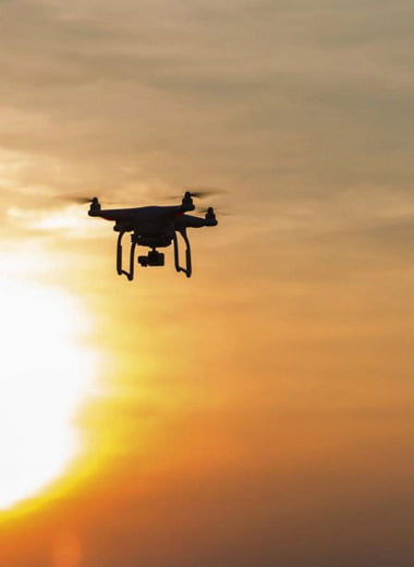
The New Benchmark for Aerial Surveying
UAVIS is a full-service commercial drone technology business dealing with everything from 3D mapping and surveying. All our drone services, drone surveys and drone inspections are carried out by qualified professionals and are in line with the Australian Civil Aviation Safety Authority (CASA) regulations. Our pilots are both Civil Aviation Safety Authority registered with a Remote Pilot Licence (RePL) under our Remote Operator’s Certificate (ReOC) with $20 million Public Liability Insurance for your peace of mind.
Our commercial UAV services range from aerial surveying, 3D mapping, LiDaR Infrastructure Inspections, assets inspections, volumetric stockpile and aggregate inspection, civil Inspections, precision agriculture, thermal imaging, photography, live video and Ultra HD video.
Call now to see how drones can help your business save money, increase safety and improve efficiency.
Our Services
Dramatically improve efficiency across multiple industries.
Inspections & Mapping
Inspections and mapping using Unmanned Aerial Vehicles (UAVs), or drones, are finding applications in an increasing number of industries. Our drones carry high-resolution cameras whilst hovering in close proximity to inaccessible areas for inspection. These drones can be launched within minutes and fly direct to the area of interest, nimble and cost-effective with photographic Orthomosaic, thermal and LiDAR solutions to capture high-density, georeferenced point clouds to produce in-depth streamlined project deliverables.
2D/3D Modeling
Orthomosaic Mapping
LiDaR Infrastructure Inspections
Vegetation Encroachment Detection
Thermal Imaging
DSM, DTM or DEM files
Volumetrics Mapping
NDVI, NDRE Vegetative Indices
Sound Complex?
It shouldn’t. You don’t have to be an engineer to enjoy the many significant benefits of UAVIS. The complexities take place on the back-end, and up front, you get to view and manipulate fascinating imagery & data.
Drone inspections, mapping and surveys are more efficient, cost-effective and safer
Our Contributions
Industries We Serve!
UAVs are revolutionizing the inspection industry. Below are just a few of the inspection types our pilot’s complete with drones/uav’s:
TRANSMISSION LINES INSPECTIONS
ROADS AND MARITIME INSPECTIONS
OIL & GAS PIPELINE INSPECTION
AGRICULTURE INSPECTIONS
CONFINED SPACE INSPECTIONS
SOLAR PANEL INSPECTIONS
CRITICAL INFRASTRUCTURE INSPECTIONS
BRIDGE INSPECTIONS
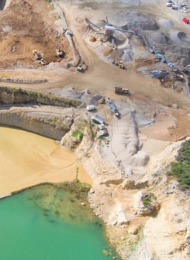
MINING INSPECTIONS
ROOF INSPECTIONS
INDUSTRIAL EQUIPMENT INSPECTIONS
WEATHER DAMAGE INSPECTIONS
CONSTRUCTION SITE INSPECTIONS
INSURANCE INSPECTIONS
Infrastructure Inspections
Power line surveys by a state of the art UAVs. allow safe efficient close proximity for Orthomosaic Mapping, LiDaR surveying and thermal inspections. The system captures in-depth vegetation encroachment and ultra high definition imagery to support recall analysis, Making it perfectly designed for demanding power line surveys.
Asset Inspections
With high-resolution imagery, thermal imaging and 3D modelling, drones provide a much richer data-set that enables more effective decision making. Instead of reacting to issues that arise, aerial technology allows you to get on the front foot and proactively manage your assets.
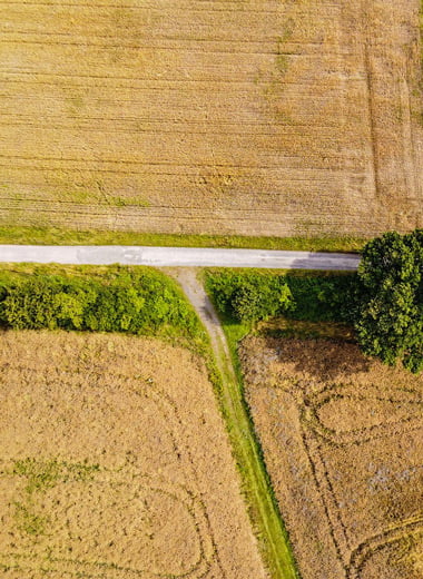
Agriculture and Farming Inspections
Regular aerial monitoring of agricultural lands can provide us with a more in-depth analysis of crop performance. Identify soil and crop issues with NDVI /NDRE Double 4K Multispectral Sensors to measure plant health instantly.