

UAV Drone Services
Optimized & Industry-ready Solutions
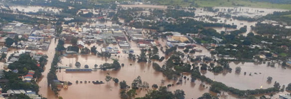
Sky-high goals
We provide innovative and reliable drone services by leveraging the advances in unmanned hardware, sophisticated LiDAR and photogrammetric surveying methods, and drone data processing techniques powered by machine learning and artificial intelligence technologies.
We are proud to provide unparallel solutions and services for sectors like construction, utilities, mining, and oil and gas, among others.
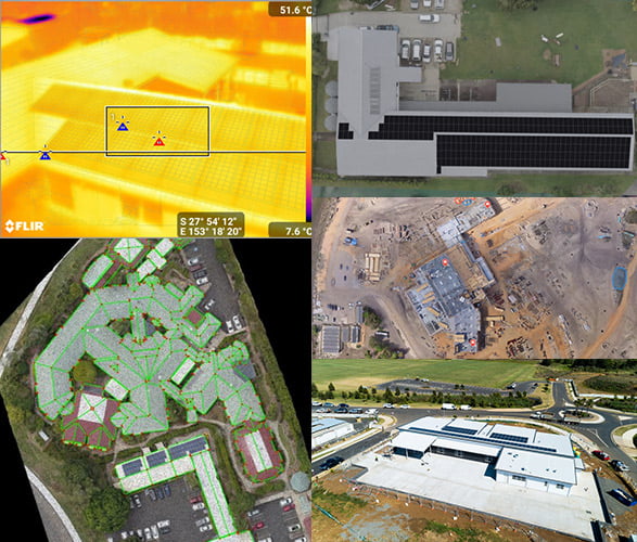
Drone imagery outputs
- Orthophotos and orthomosaics
- Thermal
- Point clouds
- Digital surface models (DSMs) and digital terrain model (DTMs)
- 3D models
- Raw images
- NDVI & NDRE
Our Innovations
UAV Drone Services!
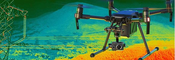
TRANSMISSION LINES INSPECTIONS
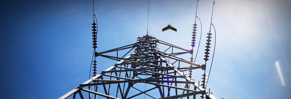
Fixed-wing drones have brought huge benefits to power and utility companies in terms of safety, compared to helicopters and other types of manned aircraft. Soaring over difficult terrain, all at a fraction of the cost of hiring a helicopter or ground crew, our UAVs payloads provide three types of data: thermal, photogrammetry and LiDAR, creating heatmaps or highly-detailed three-dimensional point cloud structures and topography bringing significant benefits for monitoring power line routes for vegetation encroachment, especially in hard-to-reach locations and difficult terrain.
OIL & GAS PIPELINE INSPECTION
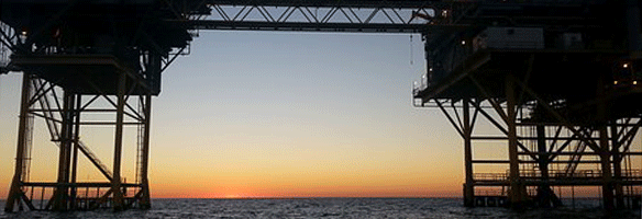
UAVIS is able to offer our clients UAV Inspections, also known as RPAS (Remotely Piloted Aircraft System). The remote sites of the Australian oil, gas and pipeline industries makes it an ideal adopter of unmanned aerial vehicles. The use of UAV’s cover everything from surveying, mapping, and monitoring of operational pipelines. Drones can assist pipeline companies with route selection, engineering and construction surveys.
UAVIS Drone Inspections keep people out of harm’s way while capturing high resolution/definition footage analyzed by our team or yours. The use of thermal imaging technology allows monitoring of leaks, hotspots, temperature changes, etc. Our pilots are certified visual inspectors with the experience to ensure a quality inspection is performed.
ROADS AND MARITIME INSPECTIONS
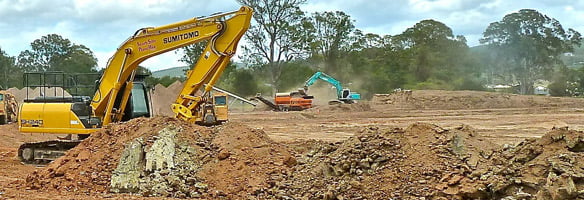
Drone data is so versatile, it can be used throughout the entire construction lifecycle, from feasibility and tendering to delivery and maintenance. UAV Road Inspections provide point clouds for your construction projects as an information source to avoid project delays. By delivering site information regularly and relying on this one “source of truth”, you will improve planning, team communication and reduce risk and delays. Bring real-world assets into the digital space and unlock a wealth of new possibilities at every stage of the project.
AGRICULTURE INSPECTIONS
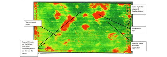
UAVIS Drones equipped with Normalized Difference Vegetation Index (NDVI) use detailed colour information to indicate plant health. Normalized Difference Red Edge Index (NDRE) is an index that can only be formulated when the Red edge band is available in a sensor. It is sensitive to chlorophyll content in leaves (how green a leaf appears), variability in leaf area, and soil background effects. Multi-spectral imagery using Unmanned Aerial Vehicle Inspection Services (UAVIS) can readily assess the VIs traits at various crop growth stages. Our Drones provide rapid reports that allow farmers to monitor crops as they grow so any problems can be dealt with fast enough to save the plants. Vegetation indices (VIs) that are mainly associated with yield and yield-related physiological traits and rapid evaluation of canopy normalized difference vegetation index (NDVI) & (NDRE) can assist in-season selection.
BRIDGE INSPECTIONS

Drones offer significant and measurable benefits in the inspection of bridges and other critical pieces of infrastructure. Drones are a safe, reliable, and cost-effective tool that can help keep workers out of harm’s way, avoid traffic detours, reduce the duration of inspections, and eliminate the need for costly heavy equipment. Our UAVs provide a detailed model using 3D point cloud and easily collect high-definition images from confined and inaccessible spaces, including underneath bridges and along beams and girders. Drones offer the potential to cut costs, provide better data, and improve worker safety during bridge inspections.
SOLAR PANEL INSPECTIONS
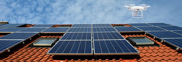
Combine drones and software to help plan, monitor, and track your solar construction project. Our solar construction software platform delivers numbers and percentages on the current state of your project. Identify problems before they occur or cause delays. Remotely oversee progress to ensure benchmarks align with project deadlines. Deliver metrics on the current state of your project to management and stakeholders.
INDUSTRIAL EQUIPMENT INSPECTIONS
Thermal imaging technology has become one of the most valuable diagnostic tools for industrial applications. By detecting anomalies that are usually invisible to the naked eye, thermal imaging allows corrective action to be taken before costly system failures occur or search for a lost person. Numerous industries have discovered the advantage of incorporating thermal imaging cameras as part of their predictive maintenance programs. As thermal cameras have become more affordable, they are now becoming an integral part of industrial companies drone toolbox.
ROOF INSPECTIONS
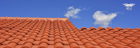
A quick, accurate bid is the difference between winning new work and seeing jobs go to the competition. Trouble is, it’s not easy to follow up on leads, inspect homes, get estimates out, and make sure you do it all quick and well. UAVIS provides you with the measurement and material details you need to get to more estimates out quicker so you never have to rush to get your job done. Plus, you can use it for any roof – even complex ones.
WEATHER DAMAGE INSPECTIONS
Lower operating costs and shorten inspection timelines by using drones (UAVIS) for roof inspections and insurance claim needs at scale. Our professional drone pilots will get the aerial property inspection imagery you need to process a claim or underwriting inspection. UAVIS insurance packages are safe, fast, ROI-positive, CASA compliant, and available nationwide.
Payload Specifications
SPECIFICATIONS
Sensors 12.3MP BSI CMOS
• Sony Exmor R™ IMX377 Sensor
Spectral bands NDVI
• Red: 625nm x 100nm width
• NIR: 850nm x 40nm width
NDRE
• Red Edge: 720nm x 40nm width
• NIR 840nm x 20nm width
Thermal Sensitivity (NEdT)
• <50 mK at f/1.0